WHAT'S NEW...
Nearly 6,000 visitors a month from all
over the world visit the Ferring Village website!!!
-
BRR, IT'S COLD!! APPEAL FOR BLANKETS FOR THE
ANIMALS AT THE CLYMPING DOG SANCTUARY:
"I
would like to appeal to the people of our lovely village for any
unwanted blankets or duvets.
These will be for the Clymping Dog Sanctuary, as the weather is cold at the
moment they need all they can get and my other half and myself have
volunteered to try and help.
I would be willing to pick them up from anybodys house in our area
and will take them to the sanctuary.
If people have any and would like to arrange pick up, they can contact me on
01903 242459 or mobile 07955081721. If we could help, that
would be wonderful and so good for the woofs. Thank you.
Brian."
([email protected])
. Yo
-
EVER
CONSIDERED RETIRING TO THE PHILIPPINES?
A British ex-pat says you won't
regret it!
Read more about what it
takes, why he says you should think abut it and what help you've got access
to.
. Yo
-
CONSERVATION
GROUP EVENTS UPDATES:
Read more...
. Yo
-
Research into Ferring Families, by Joyce Cooper.
Read more...
.
..s
-
The "Healthy Walks in Ferring" Initiative - volunteers
wanted to help initiate a programme of healthy walks in our Village. Can you
help? Read more...
.
..
-
DO YOU HAVE A DOG? Then you (and your dog) are going to
love MIDHURST!! Read more...
.
..
-
Once Upon a Time ... Ferring is rich in history and many people from
around the world send in requests for information on both the town and the
people who lived here once upon a time. If anyone can help with these
requests, please can you take a look at these page?
Can you
help? On-going requests for information and assistance
from residents and ex-residents
GENEALOGY requests:
We have received lots of requests for help in tracing families and ancestry from Ferring.
.
..
-
CLYMPING
VILLAGE FETE plus Barbecue and Jazz Evening.
Read more...
..
-
Spring is on
the way and there's nowhere more beautiful than Ferring when the buds
come out, colour starts to blaze and the beach draws us to it. For visitors
to Ferring, who need somewhere to stay with a lovely family atmosphere, we
have
Ferring Beach Bed &
Breakfast, on Ferring Sea Front
..
-
Are you interested in
anything horse-related? Then
you'll definitely want to know more about the new Sussex Horse Community on
Facebook. Read more...
.
.
-
Interested in Computers and IT? A
new LINUX group is starting up in Rustington.
Read more...
.
.
-
West Sussex: The Citizens Advice
Bureau and SHELTER have set up a new service offering free legal advice.
Read more...
.
.
-
The FRSA (Ferring Roads Scheme
Association) Minutes
are now available to download.
Click here....
.
-
An Update from the Fibromyalgia
Syndrome Support Group.
Read more...
.
.
-
St Andrews Church now has it's own
website:
www.standrewsferring.org.uk With lots of information on forthcoming
services, who's who in the Church and some fascinating snippets about the
history of the church.
.
.
-
Gigs and Live Music in Sussex -
LIVE MUSIC is on the increase in the
Midhurst area of Sussex
which is good news.
Read about
venues, types music, etc., here
.
.
-
Interested
in Cars? Specifically Austin Sevens? Mac Bonar (who is a regular contributor
of photographs to this website) now has his own
Austin Seven website which is
well worth a visit - amusing and interesting, what more could you
want from a website?!
.
.
-
"I've recently came across your web page "FEATURED
WEBSITES" and I find it to be very helpful. Today I wanted to contribute
myself and would like to suggest another link that might be useful to
others - it's
www.vouchercodes.eu website, which I use to find voucher
codes when shopping online and I've managed to make some decent savings
because of it." Tom
.
..
-
Latest Ferring Residents
websites
.
..
-
Ferring Retirement Club now has their own page on
this website with their weekly events and itinerary.
Click here...
.
..
-
Guess what?
Good
news for Ferrites - our life expectancy is three or four years
longer than elsewhere.
Click here, enter your postcode and gender ... and then start
gloating! (Thanks to Miles Stapleton for sending this in and cheering us
all up!)
.
..
- Do you enjoy walking in the beautiful Sussex
Countryside? Here's all the
information
you need to give you inspiration of where to go, what to do.
.
- Very Useful Group: Singasaurus Music Group, which
is held at St Andrews Church Centre, Greystoke Road, is a musical activity
group for babies, toddlers and pre-school children who encourage musical,
physical and social development using action songs, rhythm and pitch games,
puppets, percussion playing, stories, rhymes and movement. If you'd like to
know more, contact Cathy on [email protected]
.
- The Worthing Citizen's Advice Bureau
needs "Friends". (CAB's own website is
http://www.worthingcab.fsnet.co.uk)
..
- FADS have their own website. To read up on productions, auditions, etc., please
click here.
..
- Need to learn how to use your
computer? Ferring-based
Ross PC Training
can help you.
.
- Useful links to
SHOPS
.
-
Angmering
Dog Training Club -
1 hour lessons in East Preston. Contact Mrs
Tomlinson 01903 786217 or Una Wilson 01903 873172
|
To hire Ferring Village Hall
Click here...
___________________________________
FEATURED WEBSITES:

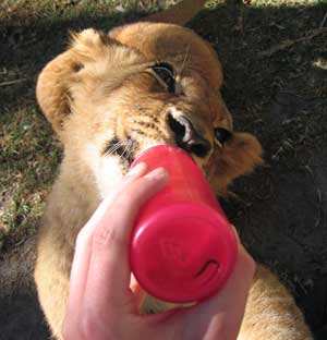
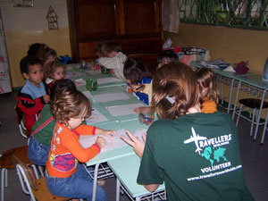
Pinnawala Elephant Orphanage in Sri
Lanka: photo by a volunteer on her
Travellers
Worldwide placement
A lovely email from a
visitor to our village and our website:
Hi Jennifer I find your website very interesting. I am not a
resident of the area just a frequent visitor so can't help with a
contribution. However, I would like you to know that I enjoy visiting
your lovely village in the summertime and reading about it during the long
dark evenings almost upon us. Best Wishes. Ron. (Ronald Potter)
Thank you, Ron!
At the best 10 pound deposit casinos, you can start with a small deposit. This way, you can try out the casino first and see if it suits you without spending a lot of money right away. Of course, you don't want to jump from casino to casino. That's why we at Znaki.fm have compiled a list of the best verified 10 pound deposit casino for you. |